Data in Use LiDAR (from Governments or private companies) and other geospatial data (satellite images, orthophotos …) Service summary Dielmo Server allows visualisation, analysis and distribution of LiDAR, raster and…
Read More
Data in Use LiDAR (from Governments or private companies) and other geospatial data (satellite images, orthophotos …) Service summary Dielmo Server allows visualisation, analysis and distribution of LiDAR, raster and…
Read More
Data in Use ERS-1, ERS-2, Envisat, Radarsat-1, Radarsat-2, ALOS, Cosmo-SkyMed, TerraSAR-X Service summary TRE processes satellite radar imagery to provide surface displacement maps to regional governments for landslide mapping. Instability…
Read More
Data in Use Service is presently using Asar and Meris data from ENVISAT, Modis data from TERRA and AQUA, Avnir2 from ALOS. Service summary SRRS performs real-time processing of satellite…
Read More
Data in Use ASAR, MERIS, MODIS, AVNIR2, FAPAR, AVHRR3 Service summary Every day, Chelys generates hundreds of real-time photorealistic images from satellite data, allowing us to monitor environmental issues such…
Read More
Data in Use phase1 – SMOS TB and SM, MODIS NDVI and LST phase 2 – SMOS and SMAP TB and SM, S-2 LAI, S-3 NDVI and LST Service summary…
Read More
Data in Use Snow observations available from weather stations and collected from professional groups on the ground Service summary SnowMonit is designed to improve current services that treat snow avalanche…
Read More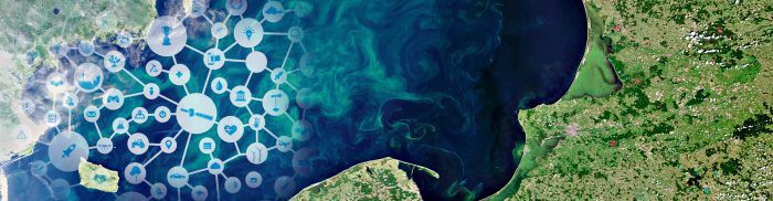
Data in Use ASAR data and in situ measurements taken by sensors for soil moisture for NDVI. MODIS and AVHRR for NDVI. Service summary The use of remote sensing provides…
Read More
Data in Use ERS 1; ERS 2; ASAR; ALOS PALSAR; AVNIR-2 ; Landsat 7; Landsat 4/5; NIR Red-Edge; CIR; Aerial Photography, DTMs, UK-DMC and UK-DMC2 Service summary Landmap provides web-based…
Read More
Data in Use Ocean colour and SST products retrieved from the MyOcean catalogue, and in-situ data to forecast blooms. Service summary The ASIMUTH project hosts a monitoring service that provides…
Read More
Data in Use EO data: MSG SEVIRI (EUMETSAT) on a 5′ basis, Landsat TM, MODIS, NPP, SPOT, VHR optical imagery, Sentinel-2 Non-EO data: RT Meteo data, OSM, CLC, ASTER DEM,…
Read More


