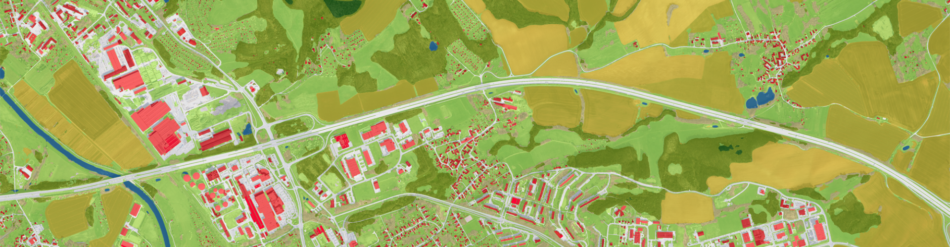
 Land cover and corresponding changes over time are an essential building block in decisionmaking, climate adaptation, and numerous digital business models. Related computations, however, regularly face the problem of varying granularity and data requirements, mostly because distinct types of areas (like cities and forests) call for different resolutions. deeeper.technology produces land cover data at sub-metre resolutions on country-wide scales using AI, Sentinel-2, and aerial imagery. This solution overcomes the issue of differences in granularity and the data requirements of various classes by merging high-resolution aerial imagery with Sentinel-2 imagery and uses a custom deep learning approach to compute land cover maps. Many use cases can benefit from this solution, and it is already seeing active use in lead generation for photovoltaic systems, the mapping of pervious surfaces with regard to water management, the correction of cadastre information, and many other applications.
deeeper.technology
Johann Heller, Jakob Heller, Joshua Becker
johann.heller@deeeper-technology.de


