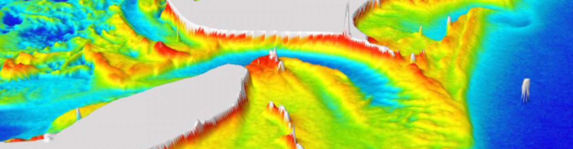
 In addition to being extremely important for navigation in any aquatic system, hydrography is necessary for environmental studies that model and monitor erosion or sedimentation processes. However, traditional hydrographic surveys are slow and costly. Multispectral imagery (MSI) offers an alternative to traditional hydrographic surveys in determining bathymetry in large and relatively shallow areas at a lower cost. This product utilises Sentinel-1 and Sentinel-2 data to offer information at medium and high spatial resolutions with short revisit periods. The solution offers bathymetric data derived from satellite multispectral imagery as a tool for identifying navigable areas. In doing so, it uses UAVs to capture very high-resolution multispectral imagery that, when combined with satellite data, provides detailed bathymetric models in critical areas.

LS – Engenharia Geográfica
Cláudio Sousa
claudio.sousa@lstopografia.com


