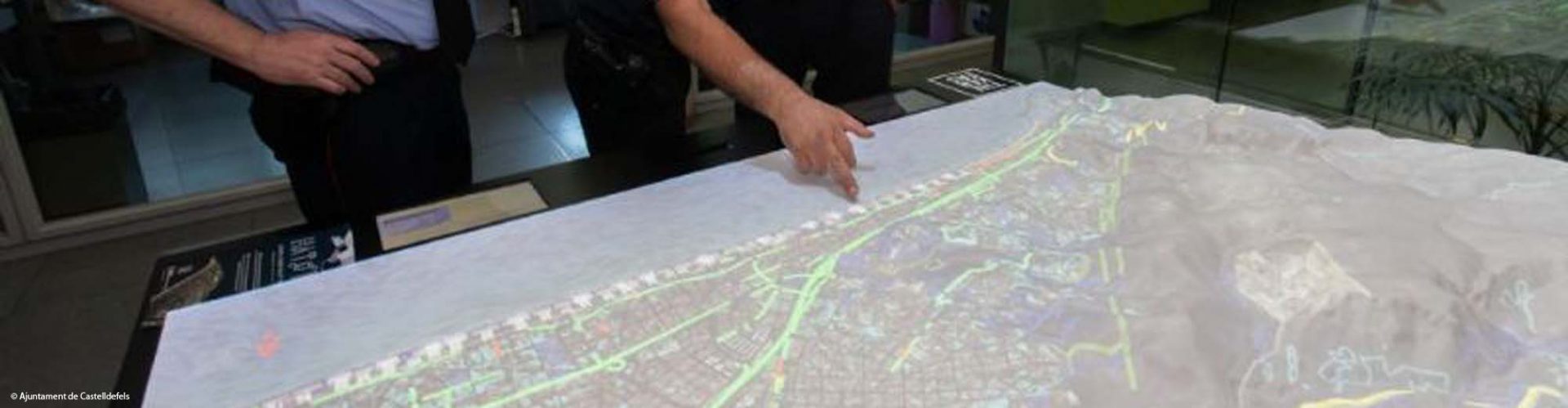
HAToM is a disruptive geospatial data visualisation platform that translates geospatial data and complex graphics into a universal “visual” language that everybody can understand, regardless of their specialisation. The core innovation behind this platform is the ability to blend different technologies and types of data from different sources and project 2D and 3D digital images onto a 3D physical model, creating a perfect digital twin of any place on Earth. HAToM’s proprietary platform consists of hardware, software, and a high-resolution 3D topographic model onto which data is projected after being analysed by our geospatial analytics tools (which leverage artificial intelligence and machine learning algorithms). The data includes images obtained from Earth observation satellites, georeferenced data, and real-time data (on weather, traffic, ships, or IoT sensors), and it can be changed or merged for simultaneous visualisation. The use of Copernicus data is fundamental, as it is used for natural resources and disaster risk reduction. The data leveraged includes Sentinel-1A/1B SAR, Sentinel-2A/2B (NDVI, IR, ARVI, etc), Sentinel-3 (OLCI (SSH), OTCI), land cover (snow, forests), climate change (ECV), and altimetry (ocean topography, wave height, ocean currents).

Tinkerers Lab
Milena Orlandini and team
orlandini@tinkerers.cc


