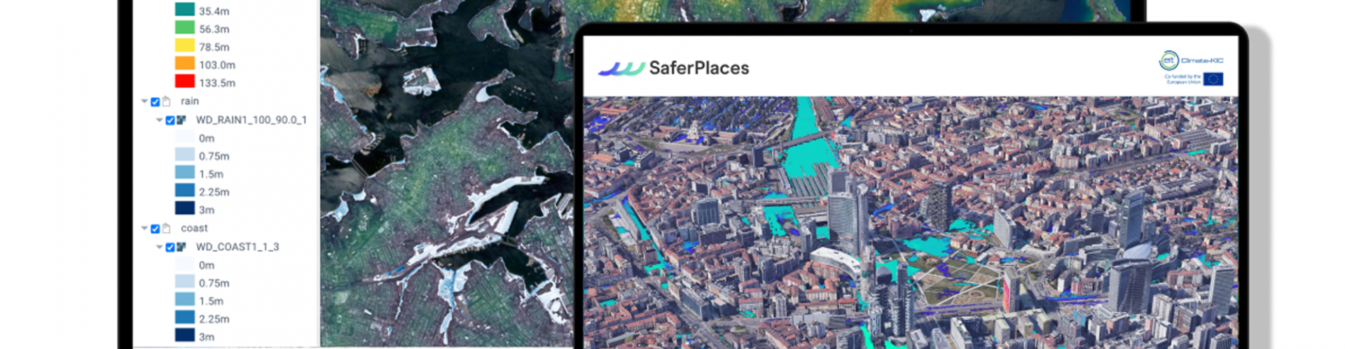
 SaferPlaces provides actionable insights to predict flood risks in any city worldwide. Due to increasing anthropogenic pressure from factors like soil sealing and the more frequent occurrence of extreme weather events, cities have been experiencing more and more severe flooding from different hazard sources such as rivers, rainfall, and coastal waters. SaferPlaces can help cities around the world prepare and build up climate resilience. Its simulations and results are run and visualised in a digital twin model of a city that is created by integrating high-resolution data from WEkEO, Copernicus, Google Earth Engine, OpenStreetMap, Planet and Amazon. SaferPlaces provides key insights into flood risks by making high-resolution information and data-driven algorithms accessible, including to non-expert users.
![]()
![]()
SaferPlaces powered by GECOsistema srl
Stefano Bagli, Paolo Mazzoli, Francesca Renzi
stefano.bagli@gecosistema.com


