TSAR AI assists emergency authorities to detect the effects of natural disasters by automating the processing of satellite imagery with Artificial Intelligence. Emergency responders can detect even small changes to water bodies and surface displacements near inhabited areas, then grade them according to their impact on populations. Sentinel 1 and TerraSAR interferometric Synthetic Aperture Radar antenna imagery data are used to detect the land surface changes.
Through effective detection of emergency situations on a pan-European scale, the lives of more than 100 million people on the continent and nearby areas can be improved.
The technology also has applications for the defense and security market, where large-scale analysis of land and sea surface is required for timely detection of important developments. This solution will come at lower cost compared to human operators and will be easier and faster to use.
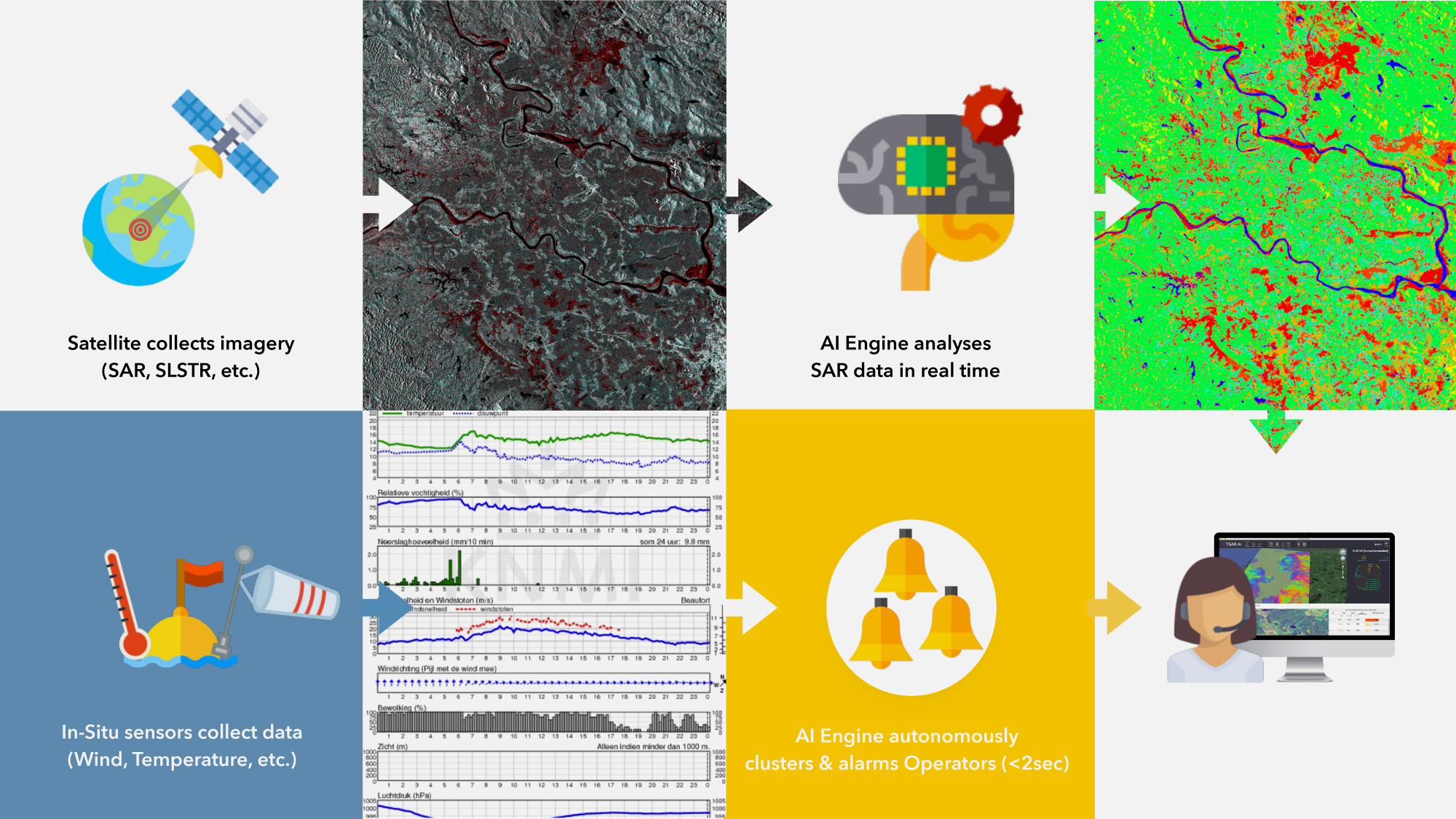
TSAR AI – Rapid and precise surface change detection with SAR data, © OPT/NET BV
Customer benefits
This solution will come at lower cost (5x less) when compared with human operators and will be easier and faster to operate. Unlike other state of the art AI solutions, it will work with unstructured satellite SAR imagery.
Expertise
“TSAR AI was selected on the basis of its high potential to contribute concretely to the development of the Copernicus emergency service, showing a high maturity both as a technical project and a business structure”. – Françoise Villette, Policy Officer, European Commission
![]()
Taras Matselyukh, Minh Ngo, Vsevolod Matselyukh, Vladislav Zaitsev, Mohan Rao, Iphigenia Keramitsoglou


