Cities are major drivers of climate change and particularly vulnerable to its effects, yet they struggle to access financial flows to implement net-zero programmes and address their citizens’ eco-anxiety. They…
Read More
Cities are major drivers of climate change and particularly vulnerable to its effects, yet they struggle to access financial flows to implement net-zero programmes and address their citizens’ eco-anxiety. They…
Read More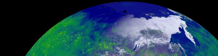
Orbiter is an Earth visualisation app for mobile devices. Designed to be accessible to everyone, the Orbiter app provides an up-to-date representation of the Earth and its processes. Using current…
Read More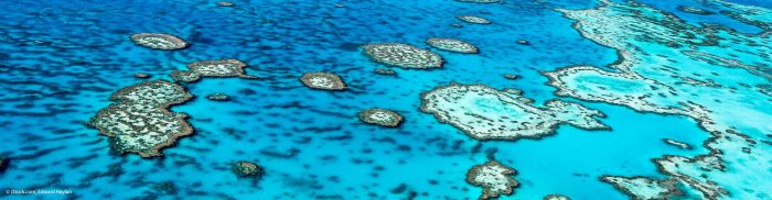
Reef Support is an online monitoring and predictive maintenance tool that uses AI and satellite imaging to track coastal reef health and prevent beach and aquaculture pollution. The system…
Read More
The mission of Green City Watch is to radically change the way nature and biodiversity is valued, to bring transparency to local government, and to regenerate cities. The technology…
Read More
CybELE aims to use satellite data to empower experts, especially in the private sector (law firms and insurance), with the management of their legal environmental cases. The global cost of…
Read More
Service summary FSSCat is an innovative mission concept consisting of two federated 6U Cubesats in support of the Copernicus Land and Marine Environment services. They carry a dual microwave payload…
Read More
Data in Use Near real-time SAR imagery (cloud independent), several updates each month, base optical map for comprehension Service summary Millions of students will monitor rainforests using (web) tools and…
Read More
Data in Use Preferred 0.5m resolution or better; two layers, panchromatic or (ideally) infrared and RGB Service summary Cerberus is a crowdsourcing and e-learning platform where participants are involved in…
Read More
Data in Use Radar images from TerraSAR-X or Sentinel-1, as well as precise weather data to compute the tropospheric delay that appeared during the SAR image data extraction; sensor data…
Read More
Data in Use Satellite Interferometric Synthetic Aperture Radar (InSAR) data Service summary PUNNET is a satellite-based land stability monitoring and mapping solution for exploration, construction, and environmental protection industries. It…
Read More


